
Holisticly integrate premier supply chains whereas client-based
bandwidth. Uniquely empower parallel.

Geophysical Services: Kanhu Charan Das | +91 9674641321, Amit Kumar Mishra | +91 9534080370
We offer a comprehensive suite of geophysical services tailored for the mining industry. These services are designed to assist in various stages of mining projects.

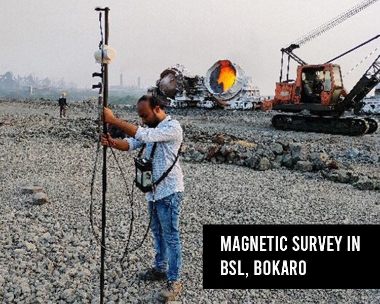
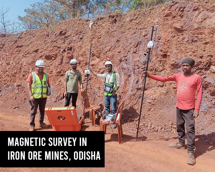
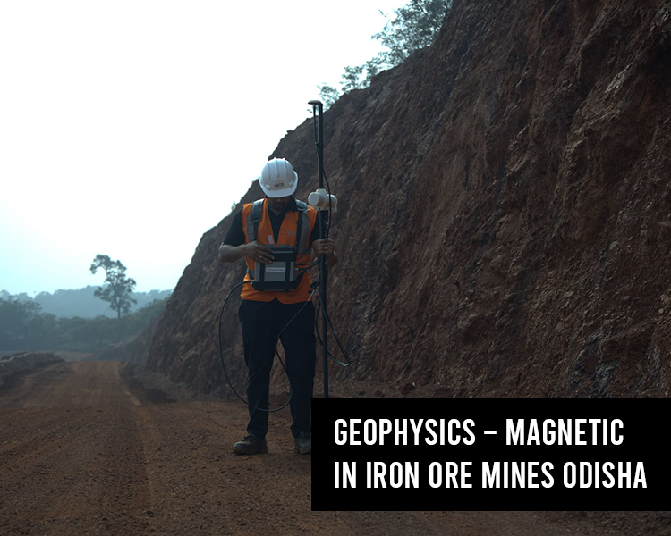
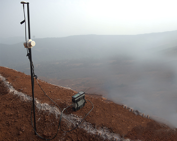
We utilize GEM 19 Proton Precession Magnetometers for various applications, including:
LOCATING AND BURIED FERROMAGNETIC OBJECTS:Detects buried items such as pipes or artifacts by identifying disturbances in the Earth's magnetic field.
ARCHAELOGY:Maps magnetic variations to uncover ancient structures or remnants of human activity.
MINERAL EXPLORATION:Detects magnetic anomalies associated with magnetic minerals, indicating potential ore deposits.
GEOLOGICAL STRUCTURE DELINEATION:Maps subsurface features, rock types, faults, and intrusions by measuring magnetic field variations.
Gravity methods, often paired with magnetic methods for enhanced accuracy and validation, have similar applications:
MINERAL EXPLORATION:Identifies subsurface density contrasts to locate mineral-rich zones.
GEOLOGICAL STRUCTURE DELINEATION:Maps subsurface structures like faults, folds, and formations.
ENGINEERING AND CONSTRUCTION:Evaluates subsurface stability for civil projects, detecting anomalies that may impact construction planning and design.
ARCHAELOGY:Detects buried structures and anomalies, aiding the identification of ancient settlements or cultural sites through density variations.
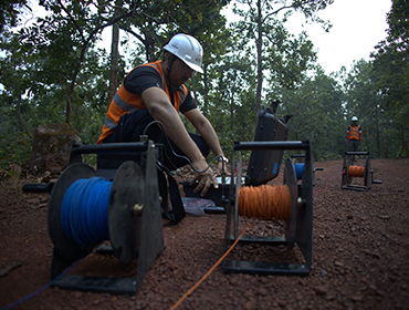
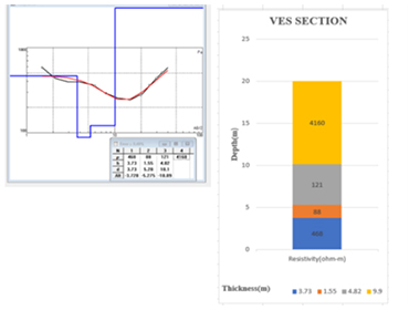
DC resistivity methods, including ER, ERI, and VES, measure
subsurface resistivity by injecting direct current into the
ground and recording the resulting voltages. This data
reveals the Earth's electrical properties and geological
composition.
ERT, a variant of this approach, uses multiple electrodes in
a linear arrangement to produce detailed subsurface
images, providing comprehensive insights into geological
formations.
We apply VES and ERT techniques for iron ore exploration in Odisha and Sierra Leone and
for analyzing metal scrap in overburden dumps at Bokaro Steel Plant, Jharkhand.
Our electrical resistivity imaging services include:
Determining depth to bedrock, water table, and geo-electric boundaries.
Identifying geological features like cavities and water channels.
Mapping aggregate deposits for quarrying.
Measuring earth resistance for grounding and cathodic protection.
All surveys follow ASTM Standard D6431-10 for data acquisition and interpretation.
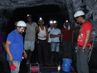
WCS uses advanced IP and SP survey equipment to explore minerals like copper, gold, graphite, zinc,
and lead, with expertise in global projects, including Zambia and DR Congo's Katangan copper
province.
Techniques Overview:
Induced Polarization (IP): Detects conductive minerals and clays in host rocks using a setup similar to ERT, employing electrodes to map subsurface composition and structure.
Self Potential (SP): Measures natural potential differences caused by groundwater flow or conductive ore bodies, offering a passive, non-intrusive way to study subsurface features.
Ground Penetrating Radar (GPR) surveys offer non-invasive subsurface profiling, detecting buried
utilities, mapping cavities, and assessing pavements without disturbing the ground. Tools like Cable &
Pipe Locators, DGPS, and Total Stations improve accuracy in locating subsurface features.
GPR can penetrate up to 60 meters in low-conductivity materials like dry sand or granite, but its
effectiveness decreases in high-conductivity materials like clay or shale.
Key Application areas:
Subsurface Utility Mapping
Cavity mapping
Pavement mapping
Concrete health monitoring

WCS deliver sefficient geophysical dataprocessing and
interpretation, saving time and costs with real-time resultsand
fast report delivery.
These services include :
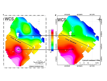
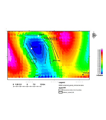
Magnetic and gravity data processing using Geosoft oasis montaj
Resistivity 1D & 2D data processing
GPR 2D & 3D data processing with output format in AutoCAD & Shapefile
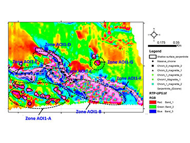
WCS specializes in advanced remote sensing analysis of multispectral and hyperspectral data, in
collaboration with satellite-based magnetic and gravity data.
Our Expertise include:
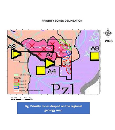
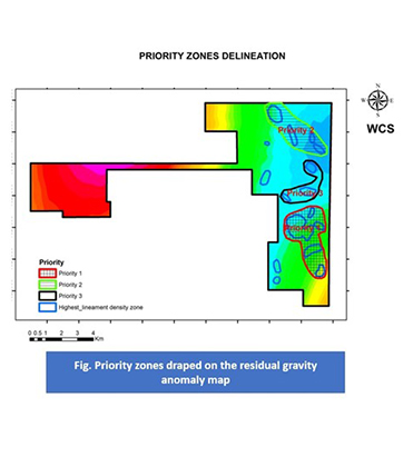
Advance desktop studies for potential mineral zone delineation using EIGEN-6C4 gravity data analysis, multispectral and hyperspectral data
Desktop study for lease area capability for mining and exploration
Advanced machine learning based studies for mineral zone delineation


Holisticly reintermediate intuitive factured products after ethical to rables. Monotonectally.