Holisticly integrate premier supply chains whereas client-based
bandwidth. Uniquely empower parallel.

Survey: P. Rabi Reddy | +91-91245 82703
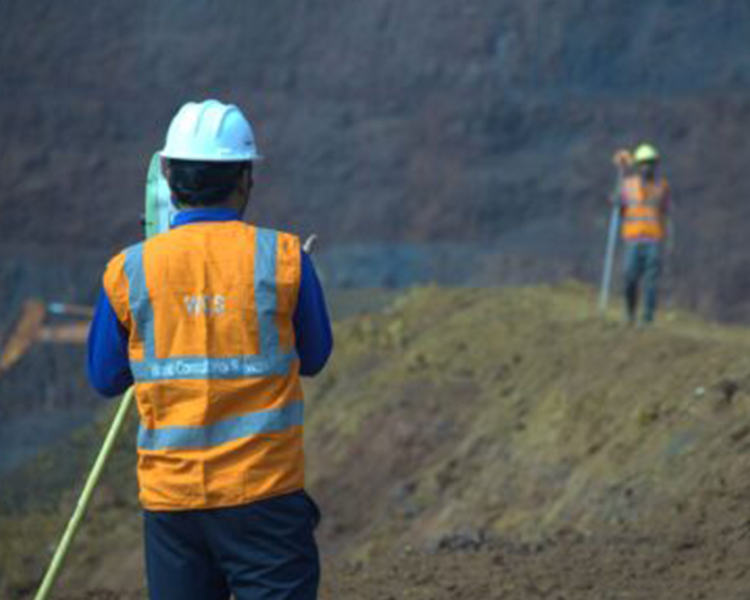
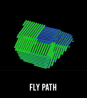
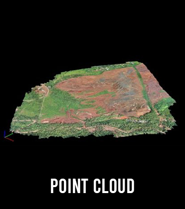
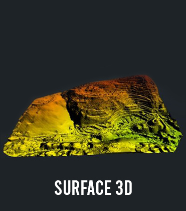
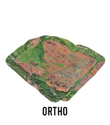
We use DGPS, drones, and terrestrial geodetic devices to build precise maps and models of the mining area's surface and subsurface terrain. This ensures that the mine's plan is consistent with its exploration data, as well as local and international regulations, assuring efficient resource extraction, safety, and regulatory compliance.

WCS provides Topographical/Levelling survey services that help in developing works of all Civil/Mining sectors. We measure the position and height of both the artificial and natural topographic features on the site (natural topographic features slopes, natural banks, and depressions in the land).
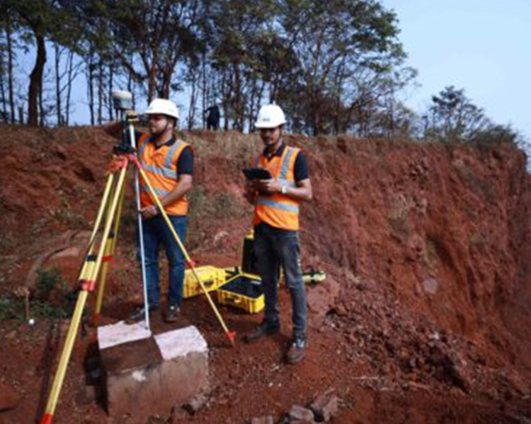


WCS has highly qualified and dedicated team having expertise in conducting cadastral surveys by using highly specialized survey equipment like Total Station, DGPS, and Drones. The detail cadastral survey is as below:
Land Use Pattern
Forest and Non-Forest Land Demarcation for FOREST CLEARANCE
Ground Feasibility Survey
Agriculture Land Survey
CA Land for Forest Clearance
Decision Support System
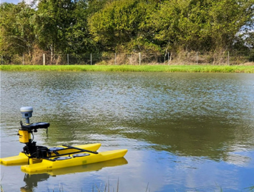
Bathymetric surveys, a type of hydrographic survey, are used to map the underwater landscape. These surveys are essential for navigation, dredging, and supporting land development projects. Data is collected from various water bodies such as rivers, lakes, and estuaries, and can also be used for flood assessments and development planning. Typically, these surveys are carried out using an echo sounder on a survey boat. As the boat moves, the echo sounder generates electrical signals that are converted into soundwaves by an underwater transducer. These soundwaves reflect off underwater features, and the echo is processed to calculate the distance to those features. WCS brings extensive expertise, advanced technology, and experience, having completed over 50 projects in Odisha this financial year for both municipal and private clients.
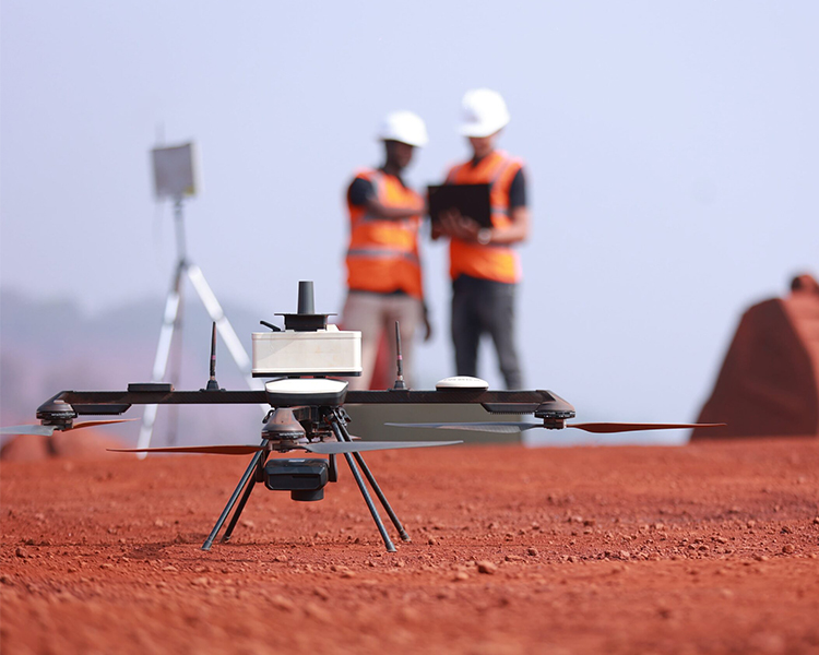
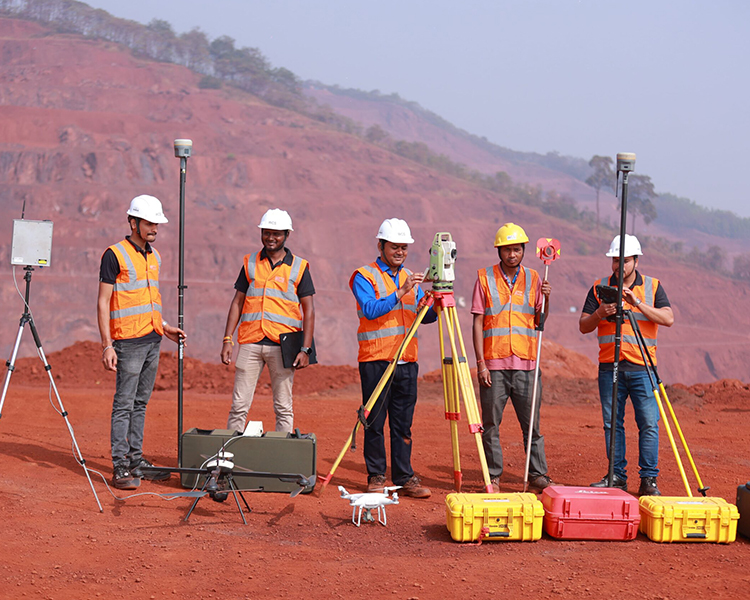
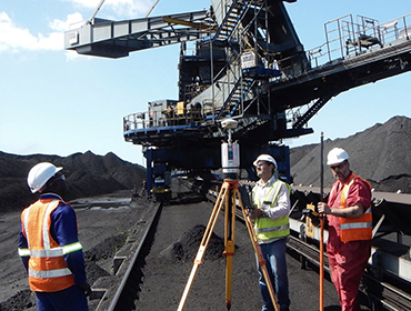
Our specialists perform comprehensive mine surveys using advanced equipment such as Total Station, dual-frequency DGPS, and drones, which include:
Boundary Survey & Stake Out
Topographic & Contour Survey
Stock Survey/ Volume Calculation
Bench Survey
Our specialists perform comprehensive mine surveys using advanced equipment such as Total Station, dual-frequency DGPS, and drones, which include:
Pipeline Survey
Road Survey
Transmission Line Survey
Conveyor Line Survey


Holisticly reintermediate intuitive factured products after ethical to rables. Monotonectally.